Follow Ed behind the scenes by learning the science of long-range hurricane tropical storms forming predictions.
Since hurricanes are capable of incredible destruction, forecasts of future hurricane activity are highly anticipated. They’re headline items even in today’s supercharged news cycle. So, how are these long-range forecasts made, and how accurate are they?
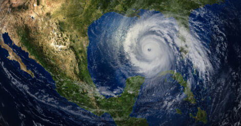
When we’re talking about hurricane forecasts, we’re referring to the Atlantic Basin, which includes all of the North Atlantic (north of the equator), the Caribbean Sea, and the Gulf of Mexico. The Atlantic Basin has the largest year-to-year variability in hurricane activity in the world.
Elements of Hurricane Forecasts
First, let’s go through some terminology. Tropical cyclones are low-pressure areas that develop over warm water and have a warm core. If a tropical cyclone produces sustained winds of at least 39 mph, it’s designated a tropical storm and given a name. If the maximum sustained winds reach 74 mph, the storm is called a hurricane. If sustained winds reach 111 mph, the hurricane is designated a major hurricane, a Category 3 on the Saffir-Simpson scale. These storms potentially cause significant loss of life and damage.
The originator of long-range hurricane forecasts was meteorologist William M. Gray, a hurricane specialist who, interestingly, worked at Colorado State University (CSU), far from the nearest ocean. CSU’s first seasonal hurricane outlook was issued by Gray and his staff in 1984. Now, the initial forecast is issued in late May, just prior to the “official” start of the Atlantic hurricane season on June 1. An updated forecast is issued in late July, still before the peak of hurricane activity in August and September.
The CSU forecast includes the number of named storms, hurricanes, and major hurricanes that may occur; the number of days that named storms, hurricanes, and major hurricanes may occur; a measure of total energy from these storms, called the “accumulated cyclone energy”; and an overall measure of the hurricane season.
Besides the CSU forecast, there are other groups that produce seasonal hurricane forecasts. The North Atlantic Hurricane Season Outlook is an official product of the National Oceanic and Atmospheric Administration (NOAA). The outlook is produced in collaboration with hurricane experts from NOAA’s National Hurricane Center and Atlantic Oceanographic and Meteorological Laboratory. This forecast is issued in late May and updated in early August. There are also private firms, such as AccuWeather, that produce their own seasonal hurricane forecast.
Detecting and Measuring Tropical Cyclones
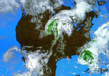
First and perhaps foremost in the analysis of tropical cyclone occurrences is the ability to detect them. The first weather satellite, TIROS-1, was launched in 1960. This gave us our first continuous look at distant ocean locations. Before this, storms went undetected if they hit nothing. Satellite imagery analysis is so advanced that the strength of a tropical cyclone can be accurately estimated by the appearance of the storm. When a tropical cyclone is close enough to be reached by plane and represents a potential threat, the famed NOAA Hurricane Hunters will fly into it to get even more accurate readings.
In 2025, Hurricane Melissa developed near-record strength while sitting over exceptionally deep, warm water in the Caribbean Sea. At one point, its maximum winds increased by nearly 60 mph in 24 hours. And at its peak, Melissa had sustained winds estimated at 184 mph with gusts over 200 mph.
Key Factors in Long-Range Forecasting
What factors do meteorologists look at when they make these long-range hurricane forecasts? Statistical analysis is a major tool they use. First, they look at overall trends for both the number of storms and their strength. In recent years, they’ve noted more and stronger storms.
Since tropical cyclones develop over water and derive their energy from warm water, ocean temperatures are critical. Typically, the minimum water temperature for tropical cyclone development is about 80 degrees F. And it’s not just surface-water temperatures; the depth of warm water (heat content) is important. Hurricanes can quickly use up the energy from shallow warm water, and the winds in a storm will mix the waters, bringing up water from below, which is often cooler. This can result in stronger storms and the dangerous “rapid intensification” in which the maximum winds of a storm increase 35 mph or more in 24 hours.
Statistical analysis has shown a correlation between Atlantic hurricane activity and the El Niño/La Niña cycle in the tropical Pacific Ocean. El Niño, the warm phase, pumps extra energy into the atmosphere, strengthening upper-level winds that reach into the Atlantic. Stronger winds aloft impede tropical cyclone development; wind shear hinders storm development. La Niña typically results in weaker winds aloft, which allows the vertical development necessary for a tropical cyclone to intensify. Neutral conditions, neither El Niño nor La Niña, also tend to be more favorable for tropical cyclone development.
Interestingly, another factor that meteorologists consider in terms of Atlantic hurricane development is the summer monsoon season in western Africa. The active rainy season there generates the development of tropical waves of low pressure. These waves, embedded in the easterly trade winds, move westward across the tropical Atlantic. With the right conditions, these waves can develop into tropical cyclones, including the strongest hurricanes.
What Can’t Be Forecast?
Unfortunately, several elements that can affect tropical cyclone development can’t be forecast well in advance. Strong upper-level winds can occur without an El Niño event. Clouds of dust blown off the Sahara Desert can move westward across the Atlantic. This inhibits storm development by blocking sunlight, thus reducing water temperatures, and by being accompanied by very dry air in mid-levels of the atmosphere. At other times, the upper-level wind patterns that can steer even the strongest hurricanes keep these oceanic storms away from land areas to the west.
Long-range hurricane forecasts only deal with the number and potential strength of these storms. Where these storms will form and where they’ll move is impossible to forecast in advance. Possible locations of landfall and potential impacts can’t be forecast. Obviously, more storms would create a higher risk of landfall. Stronger storms would produce a greater risk of destruction. When we talk about the strength of a tropical cyclone, we’re referring only to its wind speed and lowest pressure. Potential rainfall amounts are independent of strength. All tropical cyclones, even those below hurricane strength, produce heavy rainfall. The actual amount of rain produced depends on numerous factors, including speed of movement. Slower-moving storms produce the most rain. The general public typically only considers impacts in terms of judging a hurricane season. “Quiet seasons” can still have damaging storms. Active seasons can have limited impacts, depending on landfalls.
In 2025, forecasters predicted an active season because of warm waters and favorable atmospheric conditions. Instead, strong upper-level winds suppressed storm development. The season finished near average, with 13 named storms, five hurricanes, and four major hurricanes, but no hurricanes struck the United States for the first time in a decade. Only one tropical storm developed in the Gulf and came ashore in Mexico, and only Tropical Storm Chantal came ashore in South Carolina, resulting in six deaths and $500 million in damage.
On May 21, 2026, NOAA issued its latest forecast, calling for a below-normal Atlantic hurricane season. Forecasters cited an expected El Niño pattern that should increase wind shear across the Atlantic. NOAA projected 8 to 14 named storms, 3 to 6 hurricanes, and 1 to 3 major hurricanes. Confidence of these ranges is 70 percent. Still, forecasters stress that seasonal outlooks can’t predict whether a dangerous hurricane will strike the United States.
Although ocean water temperatures are forecast to be slightly above normal and the low-level trade winds weaker than average, forecasters predict that the anticipated El Niño will hinder upper-level winds. The NOAA Climate Prediction Center says there’s an 82 percent chance of El Niño developing in May and June and an even higher probability of it lasting through the end of 2026. Other hurricane forecasting groups agreed with the below-normal activity forecast. However, these hurricane forecasters stress that there’s no way to tell this far ahead if a significant hurricane will make landfall in the U.S. So, regardless of the forecast, they strongly recommend making prudent preparations.
Dr. Ed Brotak has a Ph.D. in biometeorology from the Yale School of the Environment. As a college professor for 30-plus years, he taught students about the weather, animals, and plants. He lives in Asheville, North Carolina, with his wife, who is also a meteorologist.
Originally published in the July/August 2026 issue of Grit magazine and regularly vetted for accuracy.


